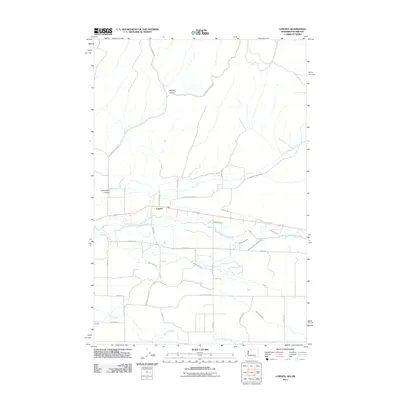
2011 Map of Lowden
USGS Topo · Published 2011About this map
Lowden sits at the heart of this agricultural landscape in the Walla Walla Valley, where a complex network of man-made waterways supports the region's farms. The Walla Walla River flows through the center of the sheet, flanked by an intricate system of irrigation features including the Garden City Ditch, Mud District Number 2 Canal, and Williams Ditch. This reliance on water management is a defining characteristic of the local geography, illustrating how the natural flow of the river has been harnessed and diverted into various canals like the Mud Creek Canal and Demaris Ditch to sustain the surrounding valley floor.
Find a feature on this map
33 named features on this map. Tap any name to fly to it.
Don’t see what you’re looking for? This feature index may not catch every label — zoom into the map to look around manually.
Map Details
Editions of this 2011 Lowden Map
This is the sole edition of this map. No revisions or reprints were ever made.
Other maps of this area

1915 · Wallulah
USGS Topo · 1:96,000

1918 · Wallula
USGS Topo · 1:125,000

1919 · Walla Walla
USGS Topo · 1:125,000

1921 · Walla Walla
USGS Topo · 1:125,000

1935 · Pendleton
USGS Topo · 1:125,000

1953 · Pendleton
USGS Topo · 1:250,000

1953 · Walla Walla
USGS Topo · 1:250,000

1956 · Pendleton
USGS Topo · 1:250,000

1958 · Walla Walla
USGS Topo · 1:250,000

1964 · Milton-Freewater
USGS Topo · 1:24,000