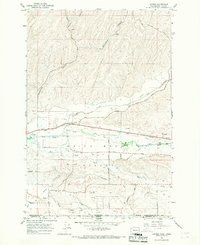
1966 Map of Lowden
USGS Topo · Published 1968About this map
The Walla Walla Valley serves as a productive agricultural corridor in the mid-1960s, defined by an intricate network of water management features and family-named roads. The landscape is dominated by the Walla Walla River and its many tributaries, supported by the Whitman Canal, Garden City Canal, and numerous unnamed ditches that irrigation the surrounding fields. The community of Lowden sits at a transport nexus, where the Union Pacific railroad and regional roads intersect near the historic Frenchtown Monument. This 1966 field-checked survey reveals the sophisticated rural infrastructure of the era, from the siphon and aqueduct systems to the numerous wells and gravel pits scattered through the drainage basins. Settlement patterns follow the fertile flats between Woodward Canyon and Mud Creek, with arterial routes like Burlingame Road and Frog Hollow Road connecting the scattered farmsteads and agricultural centers of this border region.
Find a feature on this map
40 named features on this map. Tap any name to fly to it.
Don’t see what you’re looking for? This feature index may not catch every label — zoom into the map to look around manually.
Map Details
Editions of this 1966 Lowden Map
This is the sole edition of this map. No revisions or reprints were ever made.
Other maps of this area

1915 · Wallulah
USGS Topo · 1:96,000

1918 · Wallula
USGS Topo · 1:125,000

1919 · Walla Walla
USGS Topo · 1:125,000

1921 · Walla Walla
USGS Topo · 1:125,000

1935 · Pendleton
USGS Topo · 1:125,000

1953 · Pendleton
USGS Topo · 1:250,000

1953 · Walla Walla
USGS Topo · 1:250,000

1956 · Pendleton
USGS Topo · 1:250,000

1958 · Walla Walla
USGS Topo · 1:250,000

1964 · Milton-Freewater
USGS Topo · 1:24,000