
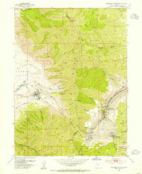
1968 Map of Lowe Peak
USGS Topo · Published 1971About this map
Lowe Peak and the high ridges of the Oquirrh Mountains dominate this late-1960s survey at the meeting point of Tooele, Salt Lake, and Utah Counties. The map documents an era of varied land use, where the Butterfield Reservation and the winding Old Military Road intersect with the region's deep mining history. The landscape is carved by deep drainages like Soldier Canyon and Middle Canyon, while numerous mineral extraction sites such as the Old Mayflower Mine, Queen Mine, and various Prospects dot the slopes of West Mtn and Butterfield Peaks. These features illustrate the industrial and strategic importance of the range during the mid-20th century. High-altitude flats like Farmers Flat and Mill Flat provide a glimpse into the terrain’s character before more modern developments, preserving the nomenclature of earlier settlers and miners who worked these canyons.
Find a feature on this map
56 named features on this map. Tap any name to fly to it.
Don’t see what you’re looking for? This feature index may not catch every label — zoom into the map to look around manually.
Map Details
Editions of this 1968 Lowe Peak Map
This is the sole edition of this map. No revisions or reprints were ever made.
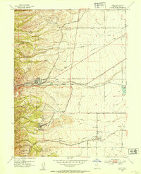
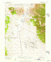
Other maps of this area

1885 · Tooele Valley
USGS Topo · 1:250,000

1915 · Fairfield
USGS Topo · 1:62,500

1917 · Fairfield
USGS Topo · 1:62,500

1918 · Stockton
USGS Topo · 1:62,500
1952 · Bingham Canyon
USGS Topo · 1:24,000
1952 · Lark
USGS Topo · 1:24,000

1953 · Tooele
USGS Topo · 1:250,000
1954 · Tickville Spring
USGS Topo · 1:24,000
1955 · Stockton
USGS Topo · 1:62,500

1955 · Tooele
USGS Topo · 1:250,000