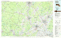
1984 Map of Lowell
USGS Topo · Published 1984About this map
The Merrimack River serves as the industrial and geographic spine of this region, connecting the major textile and manufacturing centers of Lowell, Lawrence, and Haverhill in Massachusetts with Nashua and Manchester in New Hampshire. During the mid-1980s, these cities were navigating the transition from their traditional mill-based economies toward modern urban footprints, evidenced by the dense network of highways like the F.E. Everett Turnpike and I-495 that intersect the older Boston and Maine rail corridors.
Find a feature on this map
303 named features on this map. Tap any name to fly to it.
Don’t see what you’re looking for? This feature index may not catch every label — zoom into the map to look around manually.
Map Details
Editions of this 1984 Lowell Map
This is the sole edition of this map. No revisions or reprints were ever made.
Other maps of this area

1885 · Worcester
USGS Topo · 1:62,500

1886 · Lawrence
USGS Topo · 1:62,500

1886 · Worcester
USGS Topo · 1:62,500

1886 · Lowell
USGS Topo · 1:62,500

1886 · Framingham
USGS Topo · 1:62,500

1887 · Winchendon
USGS Topo · 1:62,500

1887 · Marlboro
USGS Topo · 1:62,500

1887 · Barre
USGS Topo · 1:62,500

1887 · Fitchburg
USGS Topo · 1:62,500

1888 · Newburyport
USGS Topo · 1:62,500