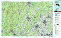
1988 Map of Lowell
USGS Topo · Published 1988About this map
The industrial corridor of the Merrimack River serves as the focal point of this late-1980s landscape, connecting the dense urban centers of Lowell, Lawrence, and Nashua. This survey reveals the complex transportation network and land-use patterns of the Merrimack Valley at a time of significant suburban growth. To the west, the terrain rises sharply into the Wapack Range and toward the prominent peak of Monadnock Mountain, illustrating the transition from the river-bottom mill towns to the upland forests of New Hampshire.
Find a feature on this map
197 named features on this map. Tap any name to fly to it.
Don’t see what you’re looking for? This feature index may not catch every label — zoom into the map to look around manually.
Map Details
Editions of this 1988 Lowell Map
2 editions found
Other maps of this area

1885 · Worcester
USGS Topo · 1:62,500

1886 · Lawrence
USGS Topo · 1:62,500

1886 · Worcester
USGS Topo · 1:62,500

1886 · Lowell
USGS Topo · 1:62,500

1886 · Framingham
USGS Topo · 1:62,500

1887 · Winchendon
USGS Topo · 1:62,500

1887 · Marlboro
USGS Topo · 1:62,500

1887 · Barre
USGS Topo · 1:62,500

1887 · Fitchburg
USGS Topo · 1:62,500

1888 · Newburyport
USGS Topo · 1:62,500