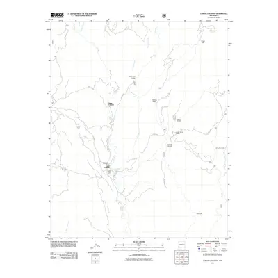
2011 Map of Lower Colonias
USGS Topo · Published 2011About this map
Cow Creek and Bull Creek converge in this northern New Mexico landscape, shaping the narrow valleys where the settlements of Upper Colonias and Lower Colonias are established. This 2011 survey reveals a region defined by its rugged drainages and ranching heritage, with the Santo Niño Cemetery serving as a significant genealogical landmark for the local community near the junction of Co RD b44b and Forest 204 RD. The map documents a network of Forest Service roads, such as Forest 83 RD and Forest 86 RD, providing access to the higher elevations of Ruidoso Ridge and Brazel Park. Private holdings like the Kay Bar Ranch and Flying Cloud Ranch are positioned along the watercourses, highlighting the continued importance of riparian land for habitation in the arid Southwest. Numerous named canyons, including Cañon Ojo Sarco and Hartman Canyon, underscore the intricate topography of the Pecos River watershed.
Find a feature on this map
29 named features on this map. Tap any name to fly to it.
Don’t see what you’re looking for? This feature index may not catch every label — zoom into the map to look around manually.
Map Details
Editions of this 2011 Lower Colonias Map
This is the sole edition of this map. No revisions or reprints were ever made.
Other maps of this area

1889 · Las Vegas
USGS Topo · 1:125,000

1889 · Santa Fe
USGS Topo · 1:125,000

1890 · Bernal
USGS Topo · 1:125,000

1891 · Bernal
USGS Topo · 1:125,000

1891 · Las Vegas
USGS Topo · 1:125,000

1893 · Las Vegas
USGS Topo · 1:125,000

1894 · Santa Fe
USGS Topo · 1:125,000

1894 · Bernal
USGS Topo · 1:125,000

1894 · Lamy
USGS Topo · 1:125,000

1954 · Santa Fe
USGS Topo · 1:250,000