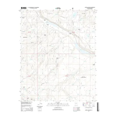
2014 Map of Lower Lake Mary
USGS Topo · Published 2014About this map
Coconino National Forest defines the character of this high-elevation landscape, where the seasonal waters of Lower Lake Mary and Upper Lake Mary provide a critical hydrological focus. The settlement of Mountainaire sits on the western edge, serving as a gateway to the wooded tracts of Anderson Mesa and the deep cuts of Walnut Canyon. This 2014 survey documents a complex network of forest resources, from the recreational path of the Arizona National Scenic Trail to essential water sources like Hoxworth Springs and Babbit Spring. The terrain is marked by numerous tanks and draws, including Howard Draw and Schoolhouse Draw, reflecting a landscape managed for both timber and watershed health. Genealogists and local historians can trace family-named landmarks such as Coulter Hill and Newman Canyon, which speak to the area's long history of ranching and early forest service administration.
Find a feature on this map
71 named features on this map. Tap any name to fly to it.
Don’t see what you’re looking for? This feature index may not catch every label — zoom into the map to look around manually.
Map Details
Editions of this 2014 Lower Lake Mary Map
This is the sole edition of this map. No revisions or reprints were ever made.
Other maps of this area

1886 · San Francisco Mtns
USGS Topo · 1:250,000

1887 · Verde
USGS Topo · 1:250,000

1891 · San Francisco Mtns
USGS Topo · 1:250,000

1892 · Verde
USGS Topo · 1:250,000

1894 · San Francisco Mtns
USGS Topo · 1:250,000

1899 · San Francisco Mtns
USGS Topo · 1:250,000

1908 · Flagstaff
USGS Topo · 1:125,000

1912 · Flagstaff
USGS Topo · 1:125,000

1923 · Camp Verde
USGS Topo · 1:125,000

1932 · Camp Verde
USGS Topo · 1:125,000