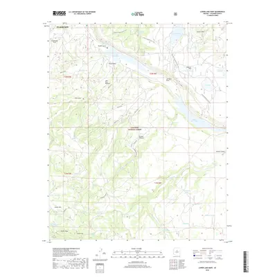
2018 Map of Lower Lake Mary
USGS Topo · Published 2018About this map
Walnut Canyon and the expansive waters of Lower Lake Mary define this high-altitude landscape south of Flagstaff. Located within the Coconino National Forest, the terrain is marked by the dramatic drop of Newman Canyon and the prominent rising plateau of Anderson Mesa. This 2018 survey illustrates a complex network of forest roads, including Hoxworth Springs Rd and Antelope Rd, which provide access to a series of remote tanks and springs such as Hoxworth Springs and Babbit Spring. The Arizona National Scenic Trail winds through the eastern half of the map, passing by Marshall Lake and Prime Lake. The map details the local hydrology, from the seasonal Walnut Creek to smaller livestock tanks like Wild Horse Tank and Hey Dog Tank, reflecting the region's historical reliance on managed water sources for ranching and forest management.
Find a feature on this map
60 named features on this map. Tap any name to fly to it.
Don’t see what you’re looking for? This feature index may not catch every label — zoom into the map to look around manually.
Map Details
Editions of this 2018 Lower Lake Mary Map
This is the sole edition of this map. No revisions or reprints were ever made.
Other maps of this area

1886 · San Francisco Mtns
USGS Topo · 1:250,000

1887 · Verde
USGS Topo · 1:250,000

1891 · San Francisco Mtns
USGS Topo · 1:250,000

1892 · Verde
USGS Topo · 1:250,000

1894 · San Francisco Mtns
USGS Topo · 1:250,000

1899 · San Francisco Mtns
USGS Topo · 1:250,000

1908 · Flagstaff
USGS Topo · 1:125,000

1912 · Flagstaff
USGS Topo · 1:125,000

1923 · Camp Verde
USGS Topo · 1:125,000

1932 · Camp Verde
USGS Topo · 1:125,000