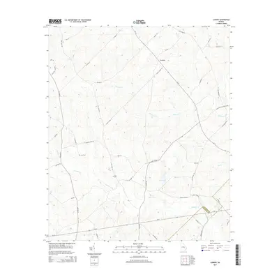
2014 Map of Lowery
USGS Topo · Published 2014About this map
Lowery serves as the central point of this rural landscape at the boundary of Laurens and Wheeler counties. The terrain is defined by a dense network of tributaries, most notably Ochwalkee Creek and Whitewater Cr, which drain the low-lying areas surrounding Swinson Lake. Settlement patterns here follow established routes like Ga 19 and Ga 46, with smaller family or local roads branching out into the countryside. For those researching local lineages, the map identifies specific points of historical interest such as Lowery Cem and Miller Cem, alongside numerous family-named roads like Greg Couey Rd, Haywood Lowery Rd, and Howard Swinson Rd. The abundance of named creeks including Flat Cr, Pitts Cr, and Buck Cr underscores the importance of water drainage in this agricultural and timber-producing region of Georgia.
Find a feature on this map
43 named features on this map. Tap any name to fly to it.
Don’t see what you’re looking for? This feature index may not catch every label — zoom into the map to look around manually.
Map Details
Editions of this 2014 Lowery Map
This is the sole edition of this map. No revisions or reprints were ever made.
Other maps of this area

1957 · Macon
USGS Topo · 1:250,000

1958 · Macon
USGS Topo · 1:250,000

1964 · Macon
USGS Topo · 1:250,000

1970 · Glenwood
USGS Topo · 1:24,000

1970 · Alamo
USGS Topo · 1:24,000

1971 · Lothair
USGS Topo · 1:24,000

1971 · Rockledge
USGS Topo · 1:24,000

1972 · Mc Rae NW
USGS Topo · 1:24,000

1974 · Lowery
USGS Topo · 1:24,000

1974 · Five Points
USGS Topo · 1:24,000