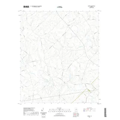
2020 Map of Lowery
USGS Topo · Published 2020About this map
Lowery lies at the heart of this rural landscape, situated along the line where Laurens County and Wheeler County meet. The area is defined by a dense network of waterways, with Ochwalkee Creek and Whitewater Creek winding through the terrain alongside Swinson Lake. This 2020 survey reveals a community organized around family-named landmarks and local roads, such as Haywood Lowery Road and Lowery Fire House Road. Genealogists will find particular value in the presence of Lowery Cemetery and Miller Cemetery, as well as the Snowhill Baptist Church located in the southern portion of the quadrangle. The map documents the persistent agricultural and rural character of this Georgia region, where small creeks like Pitts Creek and Buck Creek shape the drainage patterns of the countryside.
Find a feature on this map
53 named features on this map. Tap any name to fly to it.
Don’t see what you’re looking for? This feature index may not catch every label — zoom into the map to look around manually.
Map Details
Editions of this 2020 Lowery Map
This is the sole edition of this map. No revisions or reprints were ever made.
Other maps of this area

1957 · Macon
USGS Topo · 1:250,000

1958 · Macon
USGS Topo · 1:250,000

1964 · Macon
USGS Topo · 1:250,000

1970 · Glenwood
USGS Topo · 1:24,000

1970 · Alamo
USGS Topo · 1:24,000

1971 · Lothair
USGS Topo · 1:24,000

1971 · Rockledge
USGS Topo · 1:24,000

1972 · Mc Rae NW
USGS Topo · 1:24,000

1974 · Lowery
USGS Topo · 1:24,000

1974 · Five Points
USGS Topo · 1:24,000