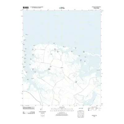
2010 Map of Lowland
USGS Topo · Published 2010About this map
Lowland sits at the heart of a highly fragmented coastal landscape where the Pamlico River meets a complex network of creeks, prongs, and marshes. This 2010 survey illustrates the deep reliance on water access in Pamlico County, centered around points of transit like Mill Seat Landing, Caraway Landing, and the Whealton Ferry crossing on Goose Creek. The land is defined by dozens of named points and hammocks, including Deep Water Point, Thorofare Point, and Reed Hammock, which provide small rises of habitable ground amidst the wetlands of Goose Creek Island. Local genealogy is anchored by the Watson Cemetery, while the infrastructure of the area is tied to routes like Lowland Rd and Hobucken School Rd. The map also details the intricate drainage system of the peninsula, including Leary Canal and the winding course of Upper Spring Creek.
Find a feature on this map
57 named features on this map. Tap any name to fly to it.
Don’t see what you’re looking for? This feature index may not catch every label — zoom into the map to look around manually.
Map Details
Editions of this 2010 Lowland Map
This is the sole edition of this map. No revisions or reprints were ever made.
Other maps of this area

1950 · Vandemere
USGS Topo · 1:24,000

1950 · Lowland
USGS Topo · 1:24,000

1950 · South Creek
USGS Topo · 1:24,000

1950 · Jones Bay
USGS Topo · 1:24,000

1951 · Brant Island
USGS Topo · 1:24,000

1951 · Pamlico Point
USGS Topo · 1:24,000

1951 · Ransomville
USGS Topo · 1:24,000

1951 · Pamlico Beach
USGS Topo · 1:24,000

1951 · Scranton
USGS Topo · 1:24,000

1953 · Rocky Mount
USGS Topo · 1:250,000