
1950 Map of Vandemere
USGS Topo · Published 1952About this map
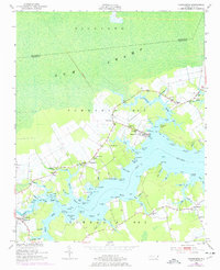
Bay River dominates the central landscape of this 1950s survey, where the intricate tidal fingers of Vandemere Creek and Chapel Creek reach into Pamlico County. The village of Vandemere sits prominently at a bend in the river, served by the Norfolk Southern RR, which provided a critical link for the transport of timber and maritime goods. The map reveals a deeply established rural social fabric, marked by numerous country churches such as St Peters Ch and Mt Zion Ch, and the local Maribel Sch near the settlement of Maribel. To the north, the massive expanse of Gum Swamp in Richland Township stands in contrast to the cleared coastal farms. This coastal topography is punctuated by dozens of family-named landmarks and points, including Lynch Beach and Gable (C), reflecting a landscape where land and water are inextricably tied.
Find a feature on this map
111 named features on this map. Tap any name to fly to it.
Don’t see what you’re looking for? This feature index may not catch every label — zoom into the map to look around manually.
Map Details
Editions of this 1950 Vandemere Map
4 editions found
Other maps of this area

1948 · Oriental
USGS Topo · 1:24,000

1950 · Lowland
USGS Topo · 1:24,000

1950 · South Creek
USGS Topo · 1:24,000

1950 · Jones Bay
USGS Topo · 1:24,000

1950 · Aurora
USGS Topo · 1:24,000

1950 · Arapahoe
USGS Topo · 1:24,000

1951 · Arapahoe
USGS Topo · 1:24,000

1951 · Broad Creek
USGS Topo · 1:24,000

1953 · Rocky Mount
USGS Topo · 1:250,000

1954 · Rocky Mount
USGS Topo · 1:250,000