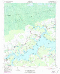
1950 Map of Vandemere
USGS Topo · Published 1983About this map
Gum Swamp dominates the northern reaches of this coastal North Carolina landscape, where the waters of the Bay River meet a complex network of creeks and points. The town of Vandemere sits as a central hub, surrounded by smaller communities such as Cash Corner, Maribel, and Mesic. This era of the landscape is defined by its social and spiritual centers, evidenced by the high density of country churches including St Peters Ch, St James Ch, and Mt Zion Ch.
Find a feature on this map
110 named features on this map. Tap any name to fly to it.
Don’t see what you’re looking for? This feature index may not catch every label — zoom into the map to look around manually.
Map Details
Editions of this 1950 Vandemere Map
4 editions found
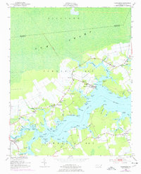
Other maps of this area

1948 · Oriental
USGS Topo · 1:24,000

1950 · Vandemere
USGS Topo · 1:24,000

1950 · Lowland
USGS Topo · 1:24,000

1950 · South Creek
USGS Topo · 1:24,000

1950 · Jones Bay
USGS Topo · 1:24,000

1950 · Aurora
USGS Topo · 1:24,000

1950 · Arapahoe
USGS Topo · 1:24,000

1951 · Arapahoe
USGS Topo · 1:24,000

1951 · Broad Creek
USGS Topo · 1:24,000

1953 · Rocky Mount
USGS Topo · 1:250,000