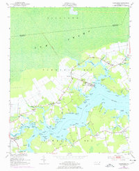
1950 Map of Vandemere
USGS Topo · Published 1977About this map
The town of Vandemere and the surrounding coastline of Pamlico County are defined by a complex network of tidal creeks and brackish bays during this mid-century period. Settled along the northern bank of the Bay River, the village shows its maritime character through features like the Marine RR and various landings at Darby Point and Graveyard Point. To the north, the vast Richland Gum Swamp stretches toward the Beaufort County line, a wild contrast to the agricultural clearings and small communities like Mesic, Maribel, and Florence that dot the higher ground.
Find a feature on this map
101 named features on this map. Tap any name to fly to it.
Don’t see what you’re looking for? This feature index may not catch every label — zoom into the map to look around manually.
Map Details
Editions of this 1950 Vandemere Map
4 editions found
Other maps of this area

1948 · Oriental
USGS Topo · 1:24,000

1950 · Vandemere
USGS Topo · 1:24,000

1950 · Lowland
USGS Topo · 1:24,000

1950 · South Creek
USGS Topo · 1:24,000

1950 · Jones Bay
USGS Topo · 1:24,000

1950 · Aurora
USGS Topo · 1:24,000

1950 · Arapahoe
USGS Topo · 1:24,000

1951 · Arapahoe
USGS Topo · 1:24,000

1951 · Broad Creek
USGS Topo · 1:24,000

1953 · Rocky Mount
USGS Topo · 1:250,000