
1950 Map of Arapahoe
USGS Topo · Published 1984About this map
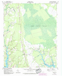
The coastal plain of Pamlico County unfolds across this 1950s survey, characterized by the expansive wetland of the Light Ground Pocosin. This distinctive shrub-bog landscape dominates the eastern portion of the map, while human settlement is clustered along the drainage systems and arterial routes like Neuse Road and Point Road. The village of Arapahoe serves as a central hub, surrounded by smaller rural pockets and family-named water features. To the south, the terrain transitions into the brackish reaches of the Neuse River, where the shoreline is marked by the seasonal destination of Minnesota Beach. A variety of small tributaries, including Dawson Creek and Beard Creek, reveal how the local topography is defined by intricate tidal guts and runs. This map records the community structures of the mid-20th century, from the Mill Dam on Deep Run to local centers of worship like St Matthews Ch and Holts Chapel.
Find a feature on this map
25 named features on this map. Tap any name to fly to it.
Don’t see what you’re looking for? This feature index may not catch every label — zoom into the map to look around manually.
Map Details
Editions of this 1950 Arapahoe Map
2 editions found
Other maps of this area

1948 · Oriental
USGS Topo · 1:24,000

1949 · Havelock
USGS Topo · 1:24,000

1949 · Merrimon
USGS Topo · 1:24,000

1949 · Cherry Point
USGS Topo · 1:24,000

1950 · Vandemere
USGS Topo · 1:24,000

1950 · Upper Broad Creek
USGS Topo · 1:24,000

1951 · Arapahoe
USGS Topo · 1:24,000
1951 · Merrimon
USGS Topo · 1:24,000
1951 · Cherry Point
USGS Topo · 1:24,000

1951 · Upper Broad Creek
USGS Topo · 1:24,000