
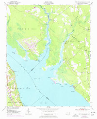
1951 Map of Upper Broad Creek
USGS Topo · Published 1951About this map
The Neuse River dominates this 1951 coastal survey, where the river's wide waters meet a network of creeks and swamps along the boundary of Craven and Pamlico counties. The landscape is defined by the significant reach of Upper Broad Creek and its many offshoots, including Goose Creek and Duck Creek. Small maritime landings like Lees Landing, Wood Landing, and Fisher Landing Pt suggest a history of water-based commerce and travel. On the western bank, the Croatan National Forest borders the Atlantic and East Carolina RR, while the eastern side shows a scattered agricultural community centered around Scotts Store, Union Chapel, and Amity Ch. Extensive wetlands such as Gaston Swamp and Alexander Swamp isolate these small settlements, preserving a snapshot of mid-century coastal North Carolina before modern development altered the shoreline.
Find a feature on this map
42 named features on this map. Tap any name to fly to it.
Don’t see what you’re looking for? This feature index may not catch every label — zoom into the map to look around manually.
Map Details
Editions of this 1951 Upper Broad Creek Map
2 editions found
Other maps of this area

1901 · New Bern
USGS Topo · 1:62,500

1903 · New Bern
USGS Topo · 1:62,500

1942 · Maysville
USGS Topo · 1:62,500

1948 · Maysville
USGS Topo · 1:62,500

1949 · Havelock
USGS Topo · 1:24,000

1949 · Cherry Point
USGS Topo · 1:24,000

1950 · New Bern
USGS Topo · 1:24,000

1950 · Upper Broad Creek
USGS Topo · 1:24,000

1950 · Arapahoe
USGS Topo · 1:24,000

1951 · Arapahoe
USGS Topo · 1:24,000