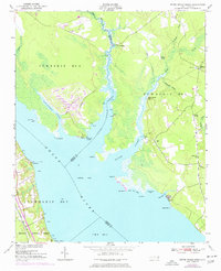
1951 Map of Upper Broad Creek
USGS Topo · Published 1977About this map
Upper Broad Creek and the wide reaches of the Neuse River define this coastal landscape on the border of Craven and Pamlico counties. The 1974 photorevisions, marked in purple, highlight significant residential development and road expansions around Northwest Creek and the Half-Moon area, contrasting with the traditional riverine settlements. Older landmarks such as Lees Landing and Wood Landing sit alongside established community centers like Scotts Store.
Find a feature on this map
42 named features on this map. Tap any name to fly to it.
Don’t see what you’re looking for? This feature index may not catch every label — zoom into the map to look around manually.
Map Details
Editions of this 1951 Upper Broad Creek Map
2 editions found

Other maps of this area

1901 · New Bern
USGS Topo · 1:62,500

1903 · New Bern
USGS Topo · 1:62,500

1942 · Maysville
USGS Topo · 1:62,500

1948 · Maysville
USGS Topo · 1:62,500

1949 · Havelock
USGS Topo · 1:24,000

1949 · Cherry Point
USGS Topo · 1:24,000

1950 · New Bern
USGS Topo · 1:24,000

1950 · Upper Broad Creek
USGS Topo · 1:24,000

1950 · Arapahoe
USGS Topo · 1:24,000

1951 · Arapahoe
USGS Topo · 1:24,000