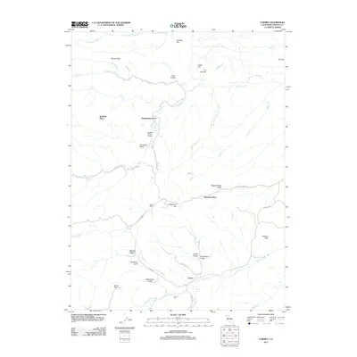
2012 Map of Lowrey
USGS Topo · Published 2012About this map
Lowrey and its surrounding ranch lands in Tehama County are defined by a complex drainage system where the N Fork Elder Cr, Middle Fork Elder Cr, and S Fork Elder Cr converge. This 2012 survey illustrates a landscape of established family holdings and rural infrastructure, from the Lowrey Cem and Jungle Spring in the south to the Big Bluff Ranch Airport further north. The terrain is marked by numerous named flats and gulches, including Bluedoor Flat and De Haven Gulch, indicating a topography of seasonal watercourses and ridges. Local transportation relies on routes like Colver Springs Rd and Lowery Rd, which connect isolated homesteads such as Montgomery Place, Saunders Place, and Miller Ranch. The map captures the enduring footprint of these foothills before the higher elevations of Gleason Peak.
Find a feature on this map
44 named features on this map. Tap any name to fly to it.
Don’t see what you’re looking for? This feature index may not catch every label — zoom into the map to look around manually.
Map Details
Editions of this 2012 Lowrey Map
This is the sole edition of this map. No revisions or reprints were ever made.
Other maps of this area

1890 · Red Bluff
USGS Topo · 1:250,000

1894 · Red Bluff
USGS Topo · 1:250,000

1944 · Flournoy
USGS Topo · 1:62,500

1949 · Colyear Springs
USGS Topo · 1:62,500

1952 · Blossom
USGS Topo · 1:24,000

1952 · Red Bank
USGS Topo · 1:24,000

1952 · Paskenta
USGS Topo · 1:62,500

1952 · Red Bank
USGS Topo · 1:62,500

1957 · Colyear Springs
USGS Topo · 1:62,500

1957 · Ukiah
USGS Topo · 1:250,000