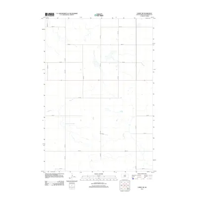
2012 Map of Lowry NW
USGS Topo · Published 2012About this map
Rieger Cr meanders across this rural section of Walworth County, carving a subtle path through the agricultural grid of northern South Dakota. The landscape is defined by the section-line road system, where corridors like 309th Ave and 312th Ave intersect with east-west routes such as 131st St and 139th St. This 2012 survey by the U.S. Geological Survey shows a terrain sparsely dotted with small water bodies and seasonal basins typical of the Missouri Plateau region. The organized geometry of the roads underscores the long-standing land divisions that have shaped local farming and ranching since settlement, offering a clear view of the area's modern spatial organization.
Find a feature on this map
15 named features on this map. Tap any name to fly to it.
Don’t see what you’re looking for? This feature index may not catch every label — zoom into the map to look around manually.
Map Details
Editions of this 2012 Lowry NW Map
This is the sole edition of this map. No revisions or reprints were ever made.
Other maps of this area

1953 · McIntosh
USGS Topo · 1:250,000

1954 · Aberdeen
USGS Topo · 1:250,000

1956 · Aberdeen
USGS Topo · 1:250,000

1958 · McIntosh
USGS Topo · 1:250,000

1967 · Selby
USGS Topo · 1:24,000

1968 · Akaska
USGS Topo · 1:24,000

1968 · Akaska NE
USGS Topo · 1:24,000

1974 · Lowry
USGS Topo · 1:24,000

1974 · Hoven Muni. Airport
USGS Topo · 1:24,000

1974 · Spring Lake
USGS Topo · 1:24,000