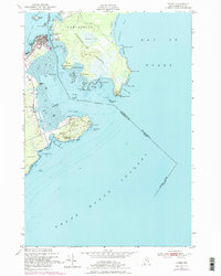
1949 Map of Lubec
USGS Topo · Published 1978About this map
Lubec stands at the easternmost edge of the United States, a coastal community defined by its proximity to the international boundary and the powerful tides of the Bay of Fundy. This mid-century survey captures the intricate maritime landscape where Lubec Channel separates the mainland from Campobello Island in New Brunswick, Canada. The map illustrates a region deeply connected to the sea, featuring the U S Coast Guard Sta No 1 and the Mulholland Pt Lighthouse (C) guarding the narrow passages. On the American side, the peninsula extends to West Quoddy Head, home to Quoddy Head State Park and landmark features like Sail Rock. The terrain varies from the developed streets of the town center to the rocky reaches of Lubec Neck and the expansive Abrahams Plains across the water, reflecting an era of active coastal navigation and cross-border geography.
Find a feature on this map
55 named features on this map. Tap any name to fly to it.
Don’t see what you’re looking for? This feature index may not catch every label — zoom into the map to look around manually.
Map Details
Editions of this 1949 Lubec Map
3 editions found
Other maps of this area

1907 · Eastport
USGS Topo · 1:48,000

1908 · Eastport
USGS Topo · 1:62,500

1917 · Cutler
USGS Topo · 1:62,500

1918 · Cutler
USGS Topo · 1:62,500

1943 · Eastport
USGS Topo · 1:62,500

1945 · Eastport
USGS Topo · 1:62,500

1949 · Eastport
USGS Topo · 1:24,000

1949 · West Lubec
USGS Topo · 1:24,000
1949 · Moose River
USGS Topo · 1:24,000
1949 · Lubec
USGS Topo · 1:24,000