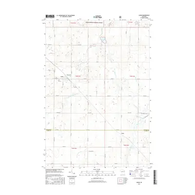
2015 Map of Lublin
USGS Topo · Published 2015About this map
Lublin sits at the heart of this central Wisconsin landscape, where the northern border of Taylor and Clark counties bisects a region defined by its numerous waterways and timberlands. The village is a focal point for genealogical research, containing the Holy Assumption Orthodox Cem, Saint Stanislaus Cem, and Saint Marys Cem all within a small radius. To the north, the Chequamegon National Forest covers the terrain, dotted by Diamond Lake and Mud Lake. The drainage pattern is complex, with the N Fork Eau Claire River and S Fork Eau Claire River winding through the western sections, while the Black River and Syrup Cr flow through the eastern half. This 2015 survey illustrates a rural landscape where section-line roads like Co Line Rd and Hickory Rd provide a structured grid over the natural glacial topography.
Find a feature on this map
43 named features on this map. Tap any name to fly to it.
Don’t see what you’re looking for? This feature index may not catch every label — zoom into the map to look around manually.
Map Details
Editions of this 2015 Lublin Map
This is the sole edition of this map. No revisions or reprints were ever made.
Other maps of this area

1951 · Lublin
USGS Topo · 1:48,000

1951 · Gilman
USGS Topo · 1:62,500

1952 · Stanley
USGS Topo · 1:62,500

1953 · Owen
USGS Topo · 1:48,000

1953 · Eau Claire
USGS Topo · 1:250,000

1953 · Rice Lake
USGS Topo · 1:250,000

1958 · Eau Claire
USGS Topo · 1:250,000

1959 · Rice Lake
USGS Topo · 1:250,000

1963 · Owen
USGS Topo · 1:62,500

1964 · Eau Claire
USGS Topo · 1:250,000