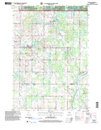
2005 Map of Lublin
USGS Topo · Published 2006About this map
Lublin serves as the primary settlement in this northern Wisconsin landscape, situated just south of the Chequamegon Nicolet National Forest. The map details a transition from the structured forestry of the Grover District to the rural townships of Roosevelt, Maplehurst, and Withee. This 2005 revision highlights the region's complex hydrology, featuring the headwaters of the Eau Claire River and the Black River, alongside recreation hubs like the Diamond Lake Recreation Area. Genealogists will find particular value in the clear marking of community landmarks such as St Marys Cem, St Stanislaus Cem, and Maplehurst Cem, which underscore the heritage of the early settlers who established these small enclaves amidst the dense woods and marshes.
Find a feature on this map
25 named features on this map. Tap any name to fly to it.
Don’t see what you’re looking for? This feature index may not catch every label — zoom into the map to look around manually.
Map Details
Editions of this 2005 Lublin Map
This is the sole edition of this map. No revisions or reprints were ever made.
Other maps of this area

1951 · Lublin
USGS Topo · 1:48,000

1951 · Gilman
USGS Topo · 1:62,500

1952 · Stanley
USGS Topo · 1:62,500

1953 · Owen
USGS Topo · 1:48,000

1953 · Eau Claire
USGS Topo · 1:250,000

1953 · Rice Lake
USGS Topo · 1:250,000

1958 · Eau Claire
USGS Topo · 1:250,000

1959 · Rice Lake
USGS Topo · 1:250,000

1963 · Owen
USGS Topo · 1:62,500

1964 · Eau Claire
USGS Topo · 1:250,000