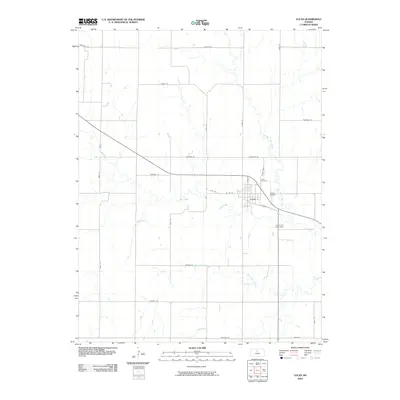
2009 Map of Lucas
USGS Topo · Published 2009About this map
Lucas serves as the central hub of this Russell County landscape, situated at the intersection of local routes like S Harvest St and 1st St. The town's layout is clearly defined against the surrounding agricultural terrain, which is segmented by a grid of named rural roads including Fairview Rd and Saline Rd. To the northeast, the Lucas Cemetery provides a primary point of interest for genealogists tracing local family roots in the area. The hydrology of the region is dominated by the meandering path of Wolf Creek and its tributary, the East Fork Wolf Creek, which feeds into the Lucas City Lake Dam south of the main settlement. Further south, the map traces the winding course of Blue Stem Creek across the open plains, illustrating the drainage patterns that have historically shaped this part of the Kansas prairie.
Find a feature on this map
29 named features on this map. Tap any name to fly to it.
Don’t see what you’re looking for? This feature index may not catch every label — zoom into the map to look around manually.
Map Details
Editions of this 2009 Lucas Map
This is the sole edition of this map. No revisions or reprints were ever made.
Other maps of this area

1894 · Ellsworth
USGS Topo · 1:125,000

1894 · Beloit
USGS Topo · 1:125,000

1896 · Osborne
USGS Topo · 1:125,000

1896 · Russell
USGS Topo · 1:125,000

1955 · Great Bend
USGS Topo · 1:250,000

1955 · Beloit
USGS Topo · 1:250,000

1957 · Great Bend
USGS Topo · 1:250,000

1958 · Great Bend
USGS Topo · 1:250,000

1959 · Beloit
USGS Topo · 1:250,000

1963 · Sylvan Grove
USGS Topo · 1:24,000