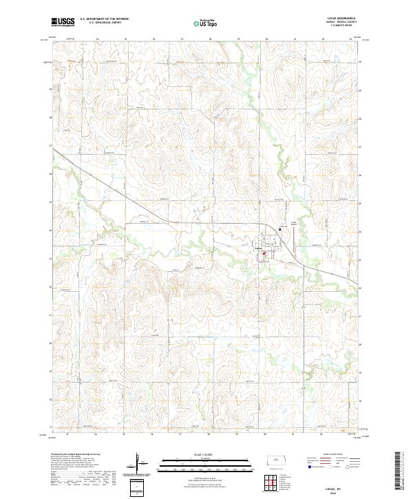
2022 Map of Lucas
USGS Topo · Published 2022About this map
Lucas serves as the central hub for this portion of Russell County, where a grid of rural section roads divides the landscape into agricultural blocks. The town is situated just south of where E Fork Wolf Cr meanders through the terrain, illustrating the relationship between mid-century prairie settlements and the natural drainage patterns of the Central Plains. The presence of Lucas Airport on the northeastern outskirts suggests the town's role in supporting regional aviation and agricultural infrastructure. Beyond the municipal limits, the landscape is defined by traditional township and range divisions, including t11s r11w and t12s r11w, which continue to dictate the layout of homesteads and farmsteads in the modern era.
Find a feature on this map
7 named features on this map. Tap any name to fly to it.
Don’t see what you’re looking for? This feature index may not catch every label — zoom into the map to look around manually.
Map Details
Editions of this 2022 Lucas Map
This is the sole edition of this map. No revisions or reprints were ever made.
Other maps of this area

1894 · Ellsworth
USGS Topo · 1:125,000

1894 · Beloit
USGS Topo · 1:125,000

1896 · Osborne
USGS Topo · 1:125,000

1896 · Russell
USGS Topo · 1:125,000

1955 · Great Bend
USGS Topo · 1:250,000

1955 · Beloit
USGS Topo · 1:250,000

1957 · Great Bend
USGS Topo · 1:250,000

1958 · Great Bend
USGS Topo · 1:250,000

1959 · Beloit
USGS Topo · 1:250,000

1963 · Sylvan Grove
USGS Topo · 1:24,000