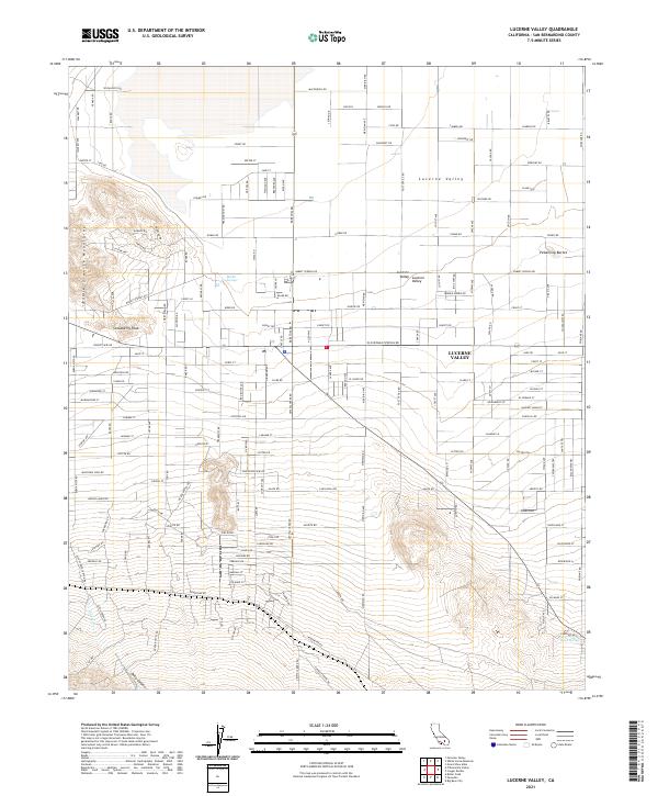
2021 Map of Lucerne Valley
USGS Topo · Published 2021About this map
Lucerne Valley occupies a prominent high-desert basin in the early 2020s, characterized by its wide-ranging residential street grid and significant topographic boundaries. The northern reaches are defined by a network of local roads such as Wacahoota Rd and Sunswept Dr, while the southern terrain rises sharply into the Granite Mountains and the heights of Strawberry Peak. This landscape reveals a complex relationship between desert development and vital water sources, as seen in the presence of Rabbit Springs and Box S Springs. To the southeast, the land breaks into the striking formations of Pickaninny Buttes, while the southwestern corner is marked by the deep incision of Deep Canyon and the seasonal path of Silver Cr. The grid-like street layout, featuring thoroughfares like Meridian Rd and Post Office Rd, suggests a community structured around its expansive natural environment.
Find a feature on this map
150 named features on this map. Tap any name to fly to it.
Don’t see what you’re looking for? This feature index may not catch every label — zoom into the map to look around manually.
Map Details
Editions of this 2021 Lucerne Valley Map
This is the sole edition of this map. No revisions or reprints were ever made.
Other maps of this area

1901 · Southern California Sheet No. 1
USGS Topo · 1:250,000

1902 · Deep Creek
USGS Topo · 1:62,500

1902 · San Gorgonio
USGS Topo · 1:125,000

1904 · Southern California Sheet No. 1
USGS Topo · 1:250,000

1932 · Barstow
USGS Topo · 1:125,000

1934 · Barstow
USGS Topo · 1:125,000

1947 · Lucerne Valley
USGS Topo · 1:62,500

1949 · Lucerne Valley
USGS Topo · 1:62,500

1953 · San Bernardino
USGS Topo · 1:250,000

1955 · Ord Mountains
USGS Topo · 1:62,500