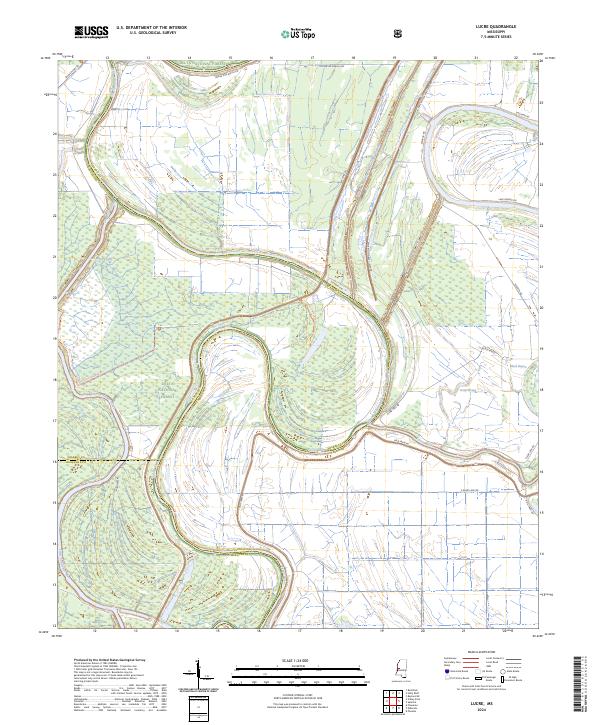
2024 Map of Lucre
USGS Topo · Published 2024About this map
Delta National Forest dominates the western half of this Mississippi Delta landscape, where the complex hydrology of the Yazoo Basin is on full display. The Yazoo River and the Little Sunflower River meander through the bottomlands, their ancient oxbows and natural levees creating a mosaic of wetlands and timber. Modern flood control is evident in the massive Will M. Whittington Auxiliary Channel, which cuts a straight path north-to-south, flanked by the W Levee Rd and Whittington East Levee Rd.
Find a feature on this map
28 named features on this map. Tap any name to fly to it.
Don’t see what you’re looking for? This feature index may not catch every label — zoom into the map to look around manually.
Map Details
Editions of this 2024 Lucre Map
This is the sole edition of this map. No revisions or reprints were ever made.
Other maps of this area

1939 · Onward
USGS Topo · 1:62,500

1939 · Lorenzen
USGS Topo · 1:62,500

1940 · Mechanicsburg
USGS Topo · 1:62,500

1955 · Jackson
USGS Topo · 1:250,000

1961 · Jackson
USGS Topo · 1:250,000

1961 · Bayland
USGS Topo · 1:62,500

1962 · Jackson
USGS Topo · 1:250,000

1963 · Mechanicsburg
USGS Topo · 1:62,500

1963 · Onward
USGS Topo · 1:62,500

1964 · Lorenzen
USGS Topo · 1:62,500