1932 Map of Ludington
USGS Topo · Published 1932About this map
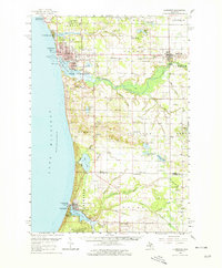
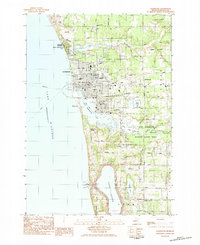
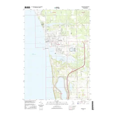
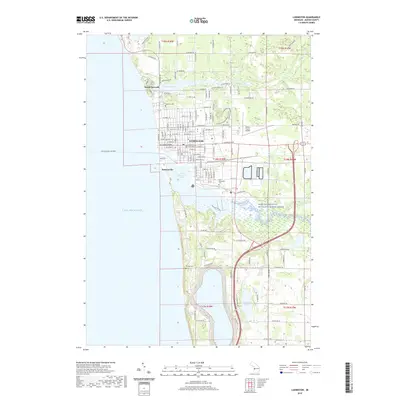
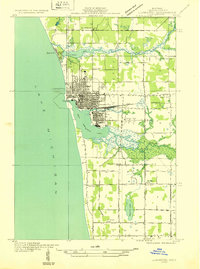
The Lake Michigan shoreline at Ludington is defined by its industrial and recreational water interfaces in the early 1930s. The dense street grid of the city sits sandwiched between Lincoln Lake to the north and the expansive Pere Marquette Lake to the south. This harbor configuration supported significant rail operations, with the Pere Marquette railroad lines converging on the waterfront near several downtown piers. North of the city, the resort character of Epworth contrasts with the surrounding agricultural sections.
Find a feature on this map
37 named features on this map. Tap any name to fly to it.
Don’t see what you’re looking for? This feature index may not catch every label — zoom into the map to look around manually.
Map Details
Editions of this 1932 Ludington Map
This is the sole edition of this map. No revisions or reprints were ever made.
Historical Maps of Ludington Through Time
9 maps found