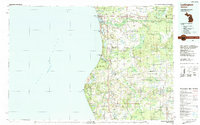
1983 Map of Ludington
USGS Topo · Published 1984About this map
Lake Michigan dominates the western half of this 1983 survey, providing the vital backdrop for the port of Ludington. The map captures the region's mid-century character, where the Chesapeake and Ohio railroad line parallels the shoreline, serving the agricultural and industrial hubs of Scottville and Shelby. Extensive public lands, including the Manistee National Forest and Pere Marquette State Forest, highlight a landscape defined by conservation and recreation. Notable coastal features like Little Sable Point and Silver Lake State Park showcase the area's famous dune geography.
Find a feature on this map
86 named features on this map. Tap any name to fly to it.
Don’t see what you’re looking for? This feature index may not catch every label — zoom into the map to look around manually.
Map Details
Editions of this 1983 Ludington Map
This is the sole edition of this map. No revisions or reprints were ever made.
Other maps of this area

1929 · Montague
USGS Topo · 1:48,000

1931 · Custer NW
USGS Topo · 1:31,680

1931 · Hart NW
USGS Topo · 1:31,680

1931 · Baldwin NW
USGS Topo · 1:31,680

1931 · Custer SW
USGS Topo · 1:31,680

1931 · Custer NE
USGS Topo · 1:31,680

1931 · Manistee SE
USGS Topo · 1:31,680

1931 · Hart SE
USGS Topo · 1:31,680

1931 · Freesoil SW
USGS Topo · 1:31,680

1931 · Manistee SW
USGS Topo · 1:31,680