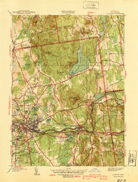
1939 Map of Ludlow
USGS Topo · Published 1939About this map
The industrial and agricultural corridor of the Chicopee River defines this pre-war survey of Hampden and Hampshire counties. The manufacturing village of Ludlow and nearby Indian Orchard showcase the high-density development typical of the region's textile and paper mill era, supported by a heavy rail network including the Boston and Albany RR. Moving north into the Facing Hills, the landscape shifts toward a rural pattern of isolated farmsteads and orchards, centered around small hamlets like Ludlow Center and Ludlow City.
Find a feature on this map
80 named features on this map. Tap any name to fly to it.
Don’t see what you’re looking for? This feature index may not catch every label — zoom into the map to look around manually.
Map Details
Editions of this 1939 Ludlow Map
This is the sole edition of this map. No revisions or reprints were ever made.
Other maps of this area

1885 · Northampton
USGS Topo · 1:62,500

1886 · Springfield
USGS Topo · 1:62,500

1886 · Northampton
USGS Topo · 1:62,500

1887 · Palmer
USGS Topo · 1:62,500

1887 · Belchertown
USGS Topo · 1:62,500

1889 · Springfield
USGS Topo · 1:62,500

1889 · Palmer
USGS Topo · 1:62,500

1890 · Belchertown
USGS Topo · 1:62,500

1891 · Northampton
USGS Topo · 1:62,500

1893 · Northampton
USGS Topo · 1:62,500