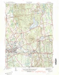
1942 Map of Ludlow
USGS Topo · Published 1942About this map
Ludlow and North Wilbraham emerge as key transit and industrial hubs along the Chicopee River during this 1930s era survey. The landscape is defined by the heavy infrastructure of the Boston and Albany railroad and the expansive Springfield Reservoir, which sits amidst the rolling elevations of Minechoag Mtn and High Hill. Institutional landmarks like the Wilbraham Academy and the Ludlow Country Club highlight the region's social development, while smaller local features like Washington Sch and School No 6 offer granular detail for local historians. The map also captures the transition from village centers like Ludlow Center to the residential growth at Indian Orchard, providing a clear view of the area's pre-war geography and the legacy of its early mills and waterworks.
Find a feature on this map
74 named features on this map. Tap any name to fly to it.
Don’t see what you’re looking for? This feature index may not catch every label — zoom into the map to look around manually.
Map Details
Editions of this 1942 Ludlow Map
This is the sole edition of this map. No revisions or reprints were ever made.
Other maps of this area

1885 · Northampton
USGS Topo · 1:62,500

1886 · Springfield
USGS Topo · 1:62,500

1886 · Northampton
USGS Topo · 1:62,500

1887 · Palmer
USGS Topo · 1:62,500

1887 · Belchertown
USGS Topo · 1:62,500

1889 · Springfield
USGS Topo · 1:62,500

1889 · Palmer
USGS Topo · 1:62,500

1890 · Belchertown
USGS Topo · 1:62,500

1891 · Northampton
USGS Topo · 1:62,500

1893 · Northampton
USGS Topo · 1:62,500