
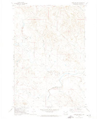
1968 Map of Ludlow
USGS Topo · Published 1971About this map
Custer National Forest anchors this Harding County landscape, where the high mesas and deep drainages of the Flint Hills meet the northern plains. The map illustrates a complex network of springs and reservoirs critical to ranching and local life, including Hime Spring, Picnic Spring, and the uniquely named High and Dry Reservoir. Cultural landmarks like Ludlow Cave and the Picnic Spring Campground reflect the area's recreational use, while several mines and a Scoria Pit point to the geological resources found within the buttes.
Find a feature on this map
36 named features on this map. Tap any name to fly to it.
Don’t see what you’re looking for? This feature index may not catch every label — zoom into the map to look around manually.
Map Details
Editions of this 1968 Ludlow Map
This is the sole edition of this map. No revisions or reprints were ever made.
Other maps of this area

1935 · Reva
USGS Topo · 1:125,000

1935 · Buffalo
USGS Topo · 1:125,000

1954 · Lemmon
USGS Topo · 1:250,000

1957 · Lemmon
USGS Topo · 1:250,000

1968 · Eagles Nest Butte
USGS Topo · 1:24,000

1968 · Tepee Buttes
USGS Topo · 1:24,000

1968 · Ludlow SE
USGS Topo · 1:24,000

1969 · Ladner NE
USGS Topo · 1:24,000

1969 · Ladner SE
USGS Topo · 1:24,000
1971 · Sheep Pen Draw
USGS Topo · 1:24,000