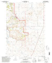
1993 Map of Ludlow
USGS Topo · Published 1996About this map
Custer National Forest lands dominate the western half of this quadrangle, where the rugged terrain of the Flint Hills meets the high plains of Harding County. This 1993 revision, based on surveys dating back to the 1960s, documents a landscape shaped by water resources and geological extraction. A network of springs and man-made catchments, including Picnic Spring, Jenkins Spring No 1, and Ash Tree Reservoir, support the region's ranching operations. The settlement of Ludlow sits on the eastern edge of the forest boundary, while the interior is marked by distinctive topographical landmarks like Rileys Butte and Riley Pass. Evidence of the area's mineral value is seen in scattered Mine symbols and a Scoria Pit, while historical features like Ludlow Cave and the uniquely named Rotten Burger Ranch provide specific points of interest for local history researchers.
Find a feature on this map
38 named features on this map. Tap any name to fly to it.
Don’t see what you’re looking for? This feature index may not catch every label — zoom into the map to look around manually.
Map Details
Editions of this 1993 Ludlow Map
This is the sole edition of this map. No revisions or reprints were ever made.
Other maps of this area

1935 · Reva
USGS Topo · 1:125,000

1935 · Buffalo
USGS Topo · 1:125,000

1954 · Lemmon
USGS Topo · 1:250,000

1957 · Lemmon
USGS Topo · 1:250,000

1968 · Eagles Nest Butte
USGS Topo · 1:24,000

1968 · Ludlow
USGS Topo · 1:24,000

1968 · Tepee Buttes
USGS Topo · 1:24,000

1968 · Ludlow SE
USGS Topo · 1:24,000

1969 · Ladner NE
USGS Topo · 1:24,000

1969 · Ladner SE
USGS Topo · 1:24,000