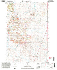
2005 Map of Ludlow
USGS Topo · Published 2007About this map
The Custer National Forest dominates this Harding County landscape, where the high ridges of the Flint Hills and Rileys Butte overlook a complex network of ephemeral drainages. The small settlement of Ludlow sits on the eastern edge of the forest, marked by a Cem and a nearby Comm Tower. The region is defined by its water management and ranching history, with numerous small impoundments like Schleichart Draw Reservoir, Ash Tree Reservoir, and High and Dry Reservoir scattered among the draws.
Find a feature on this map
40 named features on this map. Tap any name to fly to it.
Don’t see what you’re looking for? This feature index may not catch every label — zoom into the map to look around manually.
Map Details
Editions of this 2005 Ludlow Map
This is the sole edition of this map. No revisions or reprints were ever made.
Other maps of this area

1935 · Reva
USGS Topo · 1:125,000

1935 · Buffalo
USGS Topo · 1:125,000

1954 · Lemmon
USGS Topo · 1:250,000

1957 · Lemmon
USGS Topo · 1:250,000

1968 · Eagles Nest Butte
USGS Topo · 1:24,000

1968 · Ludlow
USGS Topo · 1:24,000

1968 · Tepee Buttes
USGS Topo · 1:24,000

1968 · Ludlow SE
USGS Topo · 1:24,000

1969 · Ladner NE
USGS Topo · 1:24,000

1969 · Ladner SE
USGS Topo · 1:24,000