
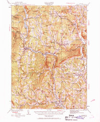
1929 Map of Ludlow
USGS Topo · Published 1961About this map
The Black River valley serves as the central corridor for industry and transport in this Vermont landscape during the late 1920s. The Rutland RR follows the river's winding path through the village of Ludlow, connecting the manufacturing hubs of Proctorsville and Cavendish. The topography is defined by significant elevations like Kingdom Mt and The Pinnacle, which hem in the narrow river valleys where settlements like Tyson and Grahamville developed.
Find a feature on this map
130 named features on this map. Tap any name to fly to it.
Don’t see what you’re looking for? This feature index may not catch every label — zoom into the map to look around manually.
Map Details
Editions of this 1929 Ludlow Map
2 editions found
Other maps of this area

1891 · Rutland
USGS Topo · 1:62,500

1893 · Wallingford
USGS Topo · 1:62,500

1893 · Rutland
USGS Topo · 1:62,500

1894 · Londonderry
USGS Topo · 1:62,500

1899 · Londonderry
USGS Topo · 1:62,500

1906 · Hanover
USGS Topo · 1:62,500

1908 · Hanover
USGS Topo · 1:62,500

1911 · Woodstock
USGS Topo · 1:62,500

1913 · Woodstock
USGS Topo · 1:62,500

1926 · Claremont
USGS Topo · 1:62,500