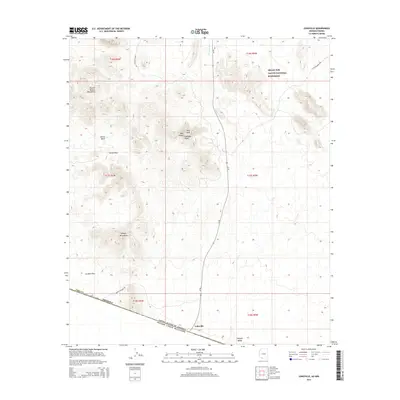
2014 Map of Lukeville
USGS Topo · Published 2014About this map
Lukeville sits at the southern edge of this desert landscape, serving as a critical gateway on the international border between the United States and Mexico. Located within the Organ Pipe Cactus National Monument, the area is defined by the high ridges of the Puerto Blanco Mountains and the Sonoyta Mountains, which overlook the expansive La Abra Plain. The topography reveals a network of dry watercourses like Cherioni Wash and specific mountain landmarks such as Twin Peaks, Levy Peak, and Gadsden Peak. This 2014 survey documents the modern layout of Az-85 as it approaches the border crossing, as well as the unpaved backcountry routes of Puerto Blanco Dr and S Ajo Mountain Dr that provide access to the remote Senita Basin and Senita Pass.
Find a feature on this map
24 named features on this map. Tap any name to fly to it.
Don’t see what you’re looking for? This feature index may not catch every label — zoom into the map to look around manually.
Map Details
Editions of this 2014 Lukeville Map
This is the sole edition of this map. No revisions or reprints were ever made.
Other maps of this area

1953 · Ajo
USGS Topo · 1:250,000

1954 · Sonoyta
USGS Topo · 1:250,000

1957 · Ajo
USGS Topo · 1:250,000

1958 · Ajo
USGS Topo · 1:250,000

1962 · Ajo
USGS Topo · 1:250,000

1963 · Ajo
USGS Topo · 1:250,000

1963 · Mt. Ajo
USGS Topo · 1:62,500

1963 · Lukeville
USGS Topo · 1:62,500

1963 · Kino Peak
USGS Topo · 1:62,500

1963 · Lukeville
USGS Topo · 1:250,000