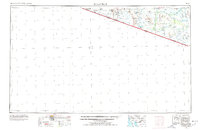
1963 Map of Lukeville
USGS Topo · Published 1978About this map
Organ Pipe Cactus National Monument and the Papago Indian Reservation dominate this mid-century survey of the Arizona-Mexico border. The map documents a landscape defined by desert hydrology and isolated settlements, centered on the international crossing at Lukeville. Along the border, the U S Customs and Immigration Reserve stands as a key point of transit between Arizona and Sonora.
Find a feature on this map
68 named features on this map. Tap any name to fly to it.
Don’t see what you’re looking for? This feature index may not catch every label — zoom into the map to look around manually.
Map Details
Editions of this 1963 Lukeville Map
2 editions found

Other maps of this area

1934 · Silver Bell
USGS Topo · 1:125,000

1937 · Comobabi
USGS Topo · 1:48,000

1941 · Vamori
USGS Topo · 1:62,500

1941 · Sells
USGS Topo · 1:62,500

1942 · Yuma
USGS Topo · 1:250,000

1942 · Comobabi
USGS Topo · 1:62,500

1943 · Sells
USGS Topo · 1:62,500

1943 · Fresnal
USGS Topo · 1:125,000

1943 · Vamori
USGS Topo · 1:62,500

1953 · Ajo
USGS Topo · 1:250,000