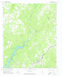
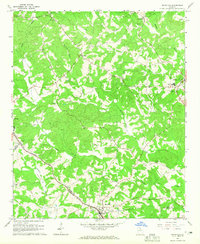
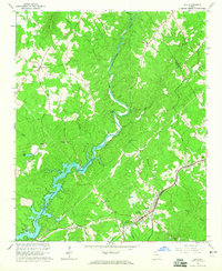
1964 Map of Lula
USGS Topo · Published 1974About this map
The Chattahoochee River carves through the heart of this North Georgia landscape, widening as it feeds into the northern reaches of Sidney Lanier Lake. The terrain is defined by its transition from the elevated peaks of Skitt Mountain in the northwest down to the rolling hills and creek valleys of Flat Creek and Mud Creek. This mid-1960s perspective captures a rural community structured around the Southern railroad line, which anchors the settlement of Lula and the nearby community of Belton. Numerous small country churches, such as Holly Springs Ch, Bethlehem Ch, and Living Mission Ch, are scattered across the quadrangle, reflecting the importance of these centers to the area's social fabric. Notable landmarks including a Lookout Tower and several family-named landmarks like Pitts Creek offer specific touchpoints for local historians and genealogists tracing early twentieth-century property lines.
Find a feature on this map
33 named features on this map. Tap any name to fly to it.
Don’t see what you’re looking for? This feature index may not catch every label — zoom into the map to look around manually.
Map Details
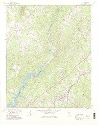
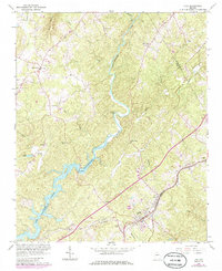
Editions of this 1964 Lula Map
4 editions found
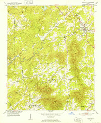
Other maps of this area

1886 · Dahlonega
USGS Topo · 1:125,000

1891 · Gainesville
USGS Topo · 1:125,000

1892 · Dahlonega
USGS Topo · 1:125,000

1896 · Dahlonega
USGS Topo · 1:125,000

1903 · Dahlonega
USGS Topo · 1:125,000
1951 · Cleveland
USGS Topo · 1:24,000

1954 · Greenville
USGS Topo · 1:250,000

1958 · Greenville
USGS Topo · 1:250,000
1964 · Maysville
USGS Topo · 1:24,000
1964 · Lula
USGS Topo · 1:24,000