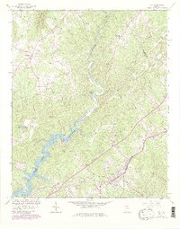
1964 Map of Lula
USGS Topo · Published 1986About this map
Lula serves as the focal point of this North Georgia survey, situated at the crossroads of the Southern railroad line and the tri-county border of Banks, Hall, and Habersham. The landscape is defined by the transition from the rolling terrain of Skitt Mountain down to the upper reaches of Lake Sidney Lanier. The waters of the Chattahoochee River wind through the center, crossed by the Belton Bridge and Lula Bridge. Numerous rural congregations, such as Pleasant Grove Ch, Bethlehem Ch, and Enon Ch, anchor the small communities that dot the hillsides. The mapping reflects a period of mid-century growth where established agricultural settlements like Glades met the rising waters of the new reservoir system.
Find a feature on this map
33 named features on this map. Tap any name to fly to it.
Don’t see what you’re looking for? This feature index may not catch every label — zoom into the map to look around manually.
Map Details
Editions of this 1964 Lula Map
4 editions found
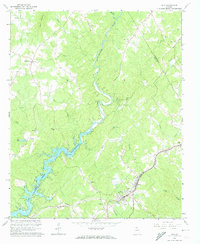
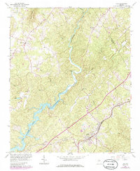
Other maps of this area

1886 · Dahlonega
USGS Topo · 1:125,000

1891 · Gainesville
USGS Topo · 1:125,000

1892 · Dahlonega
USGS Topo · 1:125,000

1896 · Dahlonega
USGS Topo · 1:125,000

1903 · Dahlonega
USGS Topo · 1:125,000

1951 · Cleveland
USGS Topo · 1:24,000

1954 · Greenville
USGS Topo · 1:250,000

1958 · Greenville
USGS Topo · 1:250,000

1964 · Maysville
USGS Topo · 1:24,000

1964 · Lula
USGS Topo · 1:24,000