
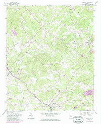
1964 Map of Maysville
USGS Topo · Published 1965About this map
Maysville sits at the nexus of several county lines in the mid-1960s, where the Southern railroad line cuts through the rolling landscape of Jackson and Banks Counties. This survey illustrates a rural Georgia landscape defined by established family settlements and a network of country churches and burial grounds. Many prominent local landmarks are documented, including Hickory Flat Ch and Mt Carmel Ch, alongside numerous family-named cemeteries such as Henderson Cem and Veal Cem.
Find a feature on this map
26 named features on this map. Tap any name to fly to it.
Don’t see what you’re looking for? This feature index may not catch every label — zoom into the map to look around manually.
Map Details
Editions of this 1964 Maysville Map
2 editions found
Other maps of this area

1891 · Gainesville
USGS Topo · 1:125,000

1891 · Carnesville
USGS Topo · 1:125,000

1954 · Greenville
USGS Topo · 1:250,000

1958 · Greenville
USGS Topo · 1:250,000

1964 · Commerce
USGS Topo · 1:24,000

1964 · Lula
USGS Topo · 1:24,000
1964 · Lake Russell
USGS Topo · 1:24,000

1964 · Pendergrass
USGS Topo · 1:24,000
1964 · Baldwin
USGS Topo · 1:24,000
1964 · Gillsville
USGS Topo · 1:24,000