
1964 Map of Commerce
USGS Topo · Published 1965About this map
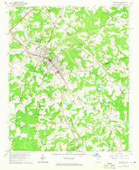
Commerce serves as a hub of activity in this 1960s survey, where the Southern railway intersects the town's expanding street grid. The landscape is dotted with small family and community burial grounds, including the centrally located Gray Hill Cem and the more remote Howington Cem near the southern border. Notable civic and commercial developments reflect the era's infrastructure, such as the Banks-Jackson-Commerce Hospital, the Bolton Airport, and a Drive-in Theater situated along the highway. To the west, the North Oconee River and Parks Creek drain the wooded hills, while multiple rural houses of worship like Mt Olive Ch and Full Gospel Tabernacle anchor the surrounding residential clusters. The map captures a moment of mid-century growth where the traditional agricultural landscape of Jackson County meets the modernizing influences of radio towers and industrial waterworks.
Find a feature on this map
38 named features on this map. Tap any name to fly to it.
Don’t see what you’re looking for? This feature index may not catch every label — zoom into the map to look around manually.
Map Details
Editions of this 1964 Commerce Map
2 editions found
Other maps of this area

1891 · Gainesville
USGS Topo · 1:125,000

1891 · Carnesville
USGS Topo · 1:125,000

1954 · Greenville
USGS Topo · 1:250,000

1958 · Greenville
USGS Topo · 1:250,000

1964 · Maysville
USGS Topo · 1:24,000

1964 · Ila
USGS Topo · 1:24,000

1964 · Ashland
USGS Topo · 1:24,000
1964 · Nicholson
USGS Topo · 1:24,000

1964 · Hull
USGS Topo · 1:24,000
1964 · Jefferson
USGS Topo · 1:24,000