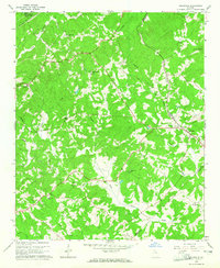
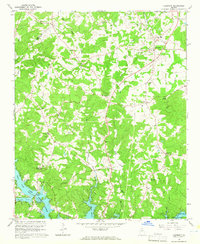
1964 Map of Gillsville
USGS Topo · Published 1965About this map
The North Oconee River and its numerous tributaries, including Buffington Mill Creek and Pond Fork, carve through the rolling landscape of the Georgia piedmont in this mid-1960s snapshot. The settlement of Gillsville serves as the primary hub along the Southern railroad line, while the northern edge of the map captures a small portion of the newly formed Lake Sidney Lanier. This era shows a community defined by its rural institutions, with local life centered around country schoolhouses like Tadmore Sch and East Hall High Sch. Many small family and church sites are visible, including the King Cem and Pine Grove Cem. A notable piece of regional infrastructure is the Covered Bridge spanning the upper reaches of the river, a remnant of older transportation patterns persisting into the mid-twentieth century.
Find a feature on this map
31 named features on this map. Tap any name to fly to it.
Don’t see what you’re looking for? This feature index may not catch every label — zoom into the map to look around manually.
Map Details
Editions of this 1964 Gillsville Map
3 editions found
Other maps of this area

1891 · Gainesville
USGS Topo · 1:125,000

1954 · Greenville
USGS Topo · 1:250,000

1958 · Greenville
USGS Topo · 1:250,000

1964 · Maysville
USGS Topo · 1:24,000

1964 · Chestnut Mountain
USGS Topo · 1:24,000

1964 · Lula
USGS Topo · 1:24,000

1964 · Gainesville
USGS Topo · 1:24,000

1964 · Pendergrass
USGS Topo · 1:24,000
1964 · Baldwin
USGS Topo · 1:24,000
1964 · Clermont
USGS Topo · 1:24,000