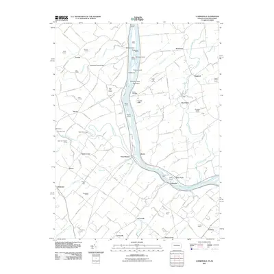
2011 Map of Lumberville
USGS Topo · Published 2011About this map
Point Pleasant and Lumberville anchor this map where the Delaware River separates Pennsylvania from New Jersey. The landscape is defined by the waterway and its history of transport and industry, featuring the Delaware and Raritan Canal alongside numerous islands like Marshall Island and Bulls Island. Engineering heritage is well-preserved here, visible through the Frankenfield Covered Bridge over Tinicum Creek and the Cabin Run Covered Bridge spanning Cabin Run.
Find a feature on this map
156 named features on this map. Tap any name to fly to it.
Don’t see what you’re looking for? This feature index may not catch every label — zoom into the map to look around manually.
Map Details
Editions of this 2011 Lumberville Map
This is the sole edition of this map. No revisions or reprints were ever made.
Other maps of this area

1890 · Easton
USGS Topo · 1:62,500

1890 · High Bridge
USGS Topo · 1:62,500

1890 · Lambertville
USGS Topo · 1:62,500

1890 · Doylestown
USGS Topo · 1:62,500

1891 · Easton
USGS Topo · 1:62,500

1891 · Lambertville
USGS Topo · 1:62,500

1891 · Doylestown
USGS Topo · 1:62,500

1894 · Lambertville
USGS Topo · 1:62,500

1898 · High Bridge
USGS Topo · 1:62,500

1900 · Raritan
USGS Topo · 1:125,000
Featured Places
- Buckingham Township, PA
- Solebury Township, PA
- Bedminster Township, PA
- Tinicum Township, PA
- Kingwood Township, NJ