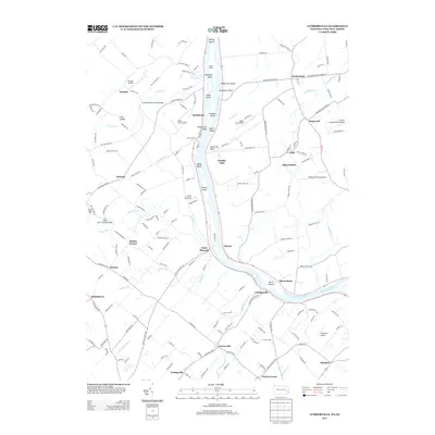
2013 Map of Lumberville
USGS Topo · Published 2013About this map
Frankenfield Covered Bridge and the Cabin Run Covered Bridge anchor the historic timber-crossing tradition of Bucks County in this 21st-century record of the Delaware River valley. The landscape is defined by the deep winding cuts of Tohickon Cr and Tinicum Cr, which feed the river near long-established riverfront hamlets like Lumberville and Point Pleasant. The map documents the persistent agricultural and preservation character of the region, where Stover Myers Mill remains a landmark of early industry. Across the water in New Jersey, the Delaware and Raritan Canal runs parallel to the shore, passing features like Devils Tea Table and Tumble Falls. A chain of river islands including Marshall Island, Walls Island, and Treasure Island creates a complex hydrologic corridor that has shaped local transportation and recreation for generations.
Find a feature on this map
174 named features on this map. Tap any name to fly to it.
Don’t see what you’re looking for? This feature index may not catch every label — zoom into the map to look around manually.
Map Details
Editions of this 2013 Lumberville Map
This is the sole edition of this map. No revisions or reprints were ever made.
Other maps of this area

1890 · Easton
USGS Topo · 1:62,500

1890 · High Bridge
USGS Topo · 1:62,500

1890 · Lambertville
USGS Topo · 1:62,500

1890 · Doylestown
USGS Topo · 1:62,500

1891 · Easton
USGS Topo · 1:62,500

1891 · Lambertville
USGS Topo · 1:62,500

1891 · Doylestown
USGS Topo · 1:62,500

1894 · Lambertville
USGS Topo · 1:62,500

1898 · High Bridge
USGS Topo · 1:62,500

1900 · Raritan
USGS Topo · 1:125,000
Featured Places
- Buckingham Township, PA
- Solebury Township, PA
- Bedminster Township, PA
- Tinicum Township, PA
- Kingwood Township, NJ