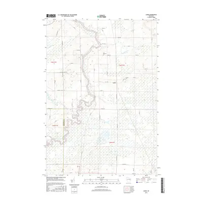
2016 Map of Lunds
USGS Topo · Published 2016About this map
The Wolf River snakes in tight meanders through the central lowlands of this Shawano County landscape, creating a broad wetland corridor that transitions into the Navarino Marsh to the south. This 2016 survey illustrates a rural environment shaped by drainage patterns and agricultural section lines, with the small settlement of Lunds serving as a local crossroads. The map is particularly useful for genealogists, as it identifies several community landmarks including Saint Wenceslaus Cem, Jerusalem Cem, and Hilda Cem. These sites, along with smaller water bodies like Schoenick Lake and School Section Cr, provide a clear picture of the established parish and family history of the region. The boundary between Waupaca Co and Shawano Co runs through the southwestern portion of the map, dividing the land near the complex bends of the river.
Find a feature on this map
52 named features on this map. Tap any name to fly to it.
Don’t see what you’re looking for? This feature index may not catch every label — zoom into the map to look around manually.
Map Details
Editions of this 2016 Lunds Map
This is the sole edition of this map. No revisions or reprints were ever made.
Other maps of this area

1954 · Shawano
USGS Topo · 1:48,000

1955 · Embarrass
USGS Topo · 1:48,000

1955 · Seymour
USGS Topo · 1:62,500

1955 · Green Bay
USGS Topo · 1:250,000

1956 · Gillett
USGS Topo · 1:62,500

1964 · Shawano
USGS Topo · 1:62,500

1969 · Leeman
USGS Topo · 1:24,000

1969 · Embarrass
USGS Topo · 1:24,000

1969 · Lunds
USGS Topo · 1:24,000

1969 · Bear Creek
USGS Topo · 1:24,000