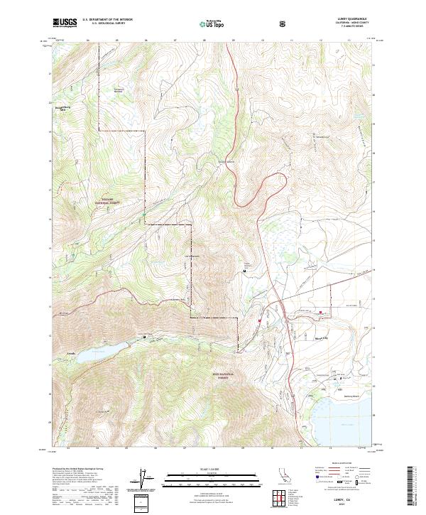
2021 Map of Lundy
USGS Topo · Published 2021About this map
Sierra Nevada peaks and deep canyons define this portion of the Eastern Sierra, where the settlement of Lundy sits at the head of Lundy Lake. The map details the transition from high-altitude meadows like Dunderberg Meadow and Sinnamon Meadow down toward the arid basin of Mono Lake. Historical industry is represented by the Dunderberg Mill and a Cinder Pit near the eastern shoreline. Significant for genealogists and local historians, several burial sites are documented including the Lundy Cem, Copper Mountain Cem, and Mono Cem. The rugged landscape is traversed by high-country routes such as the Kavanaugh Ridge Trl and Lake Canyon Trl, while the crossing at Conway Summit serves as a critical passage between the northern watersheds and the settlements of Mono City and Danburg Beach.
Find a feature on this map
54 named features on this map. Tap any name to fly to it.
Don’t see what you’re looking for? This feature index may not catch every label — zoom into the map to look around manually.
Map Details
Editions of this 2021 Lundy Map
This is the sole edition of this map. No revisions or reprints were ever made.
Other maps of this area

1901 · Mt. Lyell
USGS Topo · 1:125,000

1909 · Bridgeport
USGS Topo · 1:125,000

1911 · Bridgeport
USGS Topo · 1:125,000

1920 · Bridgeport
USGS Topo · 1:125,000

1947 · Mariposa
USGS Topo · 1:250,000

1948 · Walker Lake
USGS Topo · 1:250,000

1948 · Mariposa
USGS Topo · 1:250,000

1953 · Mono Craters
USGS Topo · 1:62,500

1956 · Matterhorn Peak
USGS Topo · 1:62,500

1956 · Tuolumne Meadows
USGS Topo · 1:62,500