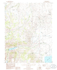
1986 Map of Lundy
USGS Topo · Published 1986About this map
Mono City and the small settlement of Lundy occupy a dramatic landscape where high Sierra peaks meet the alkaline waters of Mono Lake. This 1980s survey captures the region during a period of significant environmental observation, evidenced by the specific water level notations for Lundy Lake and the larger basin. The terrain is marked by intense mineral prospecting, with numerous labels for Prospect, Prospects, and Adit scattered across the slopes of Copper Mtn and the drainages of Virginia Creek.
Find a feature on this map
33 named features on this map. Tap any name to fly to it.
Don’t see what you’re looking for? This feature index may not catch every label — zoom into the map to look around manually.
Map Details
Editions of this 1986 Lundy Map
This is the sole edition of this map. No revisions or reprints were ever made.
Other maps of this area

1901 · Mt. Lyell
USGS Topo · 1:125,000

1909 · Bridgeport
USGS Topo · 1:125,000

1911 · Bridgeport
USGS Topo · 1:125,000

1920 · Bridgeport
USGS Topo · 1:125,000

1947 · Mariposa
USGS Topo · 1:250,000

1948 · Walker Lake
USGS Topo · 1:250,000

1948 · Mariposa
USGS Topo · 1:250,000

1953 · Mono Craters
USGS Topo · 1:62,500

1956 · Matterhorn Peak
USGS Topo · 1:62,500

1956 · Tuolumne Meadows
USGS Topo · 1:62,500