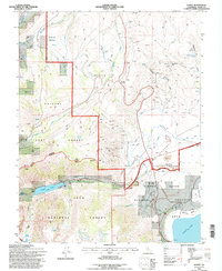
1994 Map of Lundy
USGS Topo · Published 1997About this map
Lundy Lake and the high peaks of the eastern Sierra dominate this 1990s landscape, where the waters of Mill Creek flow through Lundy Canyon toward the vast Mono Basin. The map captures a high-elevation environment defined by steep drainages like Rattlesnake Gulch and Rancheria Gulch, alongside a complex network of man-made water systems including an Aqueduct and numerous stretches of Ditch.
Find a feature on this map
46 named features on this map. Tap any name to fly to it.
Don’t see what you’re looking for? This feature index may not catch every label — zoom into the map to look around manually.
Map Details
Editions of this 1994 Lundy Map
This is the sole edition of this map. No revisions or reprints were ever made.
Other maps of this area

1901 · Mt. Lyell
USGS Topo · 1:125,000

1909 · Bridgeport
USGS Topo · 1:125,000

1911 · Bridgeport
USGS Topo · 1:125,000

1920 · Bridgeport
USGS Topo · 1:125,000

1947 · Mariposa
USGS Topo · 1:250,000

1948 · Walker Lake
USGS Topo · 1:250,000

1948 · Mariposa
USGS Topo · 1:250,000

1953 · Mono Craters
USGS Topo · 1:62,500

1956 · Matterhorn Peak
USGS Topo · 1:62,500

1956 · Tuolumne Meadows
USGS Topo · 1:62,500