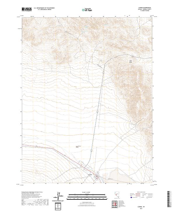
2021 Map of Luning
USGS Topo · Published 2021About this map
The small settlement of Luning occupies a central position at the base of the Gabbs Valley Range, where the alluvial fans of the mountains meet the broad expanse of Soda Spring Valley. This high-desert landscape is defined by the sharp transition between the upland terrain and the valley floor, with vital water sources such as Benton Spring, Upper Benton Spring, and Bank Spring scattered through the northern canyons. The local street grid in the town includes Plymire St and Washington St, reflecting a concentrated pocket of human activity within an otherwise vast basin. Rabbit Springs Rd serves as a primary artery through the northern sections of the map, tracing the foothills where the mountains subside into the valley. The arrangement of these features underscores the historical importance of reliable springs for sustainment in this arid region of Mineral County.
Find a feature on this map
18 named features on this map. Tap any name to fly to it.
Don’t see what you’re looking for? This feature index may not catch every label — zoom into the map to look around manually.
Map Details
Editions of this 2021 Luning Map
This is the sole edition of this map. No revisions or reprints were ever made.
Other maps of this area

1909 · Hawthorne
USGS Topo · 1:250,000

1911 · Hawthorne
USGS Topo · 1:250,000

1915 · Hawthorne
USGS Topo · 1:250,000

1948 · Walker Lake
USGS Topo · 1:250,000

1957 · Walker Lake
USGS Topo · 1:250,000

1962 · Walker Lake
USGS Topo · 1:250,000

1964 · Walker Lake
USGS Topo · 1:250,000

1967 · Mina NW
USGS Topo · 1:24,000
1967 · Mina
USGS Topo · 1:24,000
1967 · Mable Mountain
USGS Topo · 1:24,000