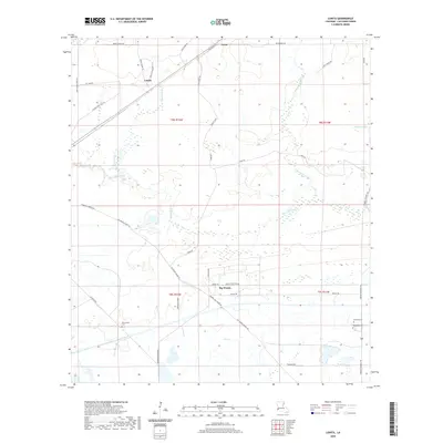
2020 Map of Lunita
USGS Topo · Published 2020About this map
Big Woods and Lunita anchor this Calcasieu Parish landscape, where the meandering course of the Houston River and Bear Head Creek define the low-lying terrain. The map documents a rural network of roads bearing local family names, such as John Storey Rd and Amos Stanley Rd, suggesting a long history of generational landholding. The area's social fabric is centered around several historic burial grounds, including Big Woods Cem, Benevolent Cem, and Antioch Cem, which serve as vital touchstones for genealogical research in this part of Louisiana.
Find a feature on this map
40 named features on this map. Tap any name to fly to it.
Don’t see what you’re looking for? This feature index may not catch every label — zoom into the map to look around manually.
Map Details
Editions of this 2020 Lunita Map
This is the sole edition of this map. No revisions or reprints were ever made.
Other maps of this area

1932 · Orange
USGS Topo · 1:62,500

1947 · Sulphur
USGS Topo · 1:31,680

1947 · Starks
USGS Topo · 1:31,680

1947 · Vinton
USGS Topo · 1:31,680

1947 · Toomey
USGS Topo · 1:31,680

1947 · Carter Creek
USGS Topo · 1:31,680

1947 · DeQuincy
USGS Topo · 1:31,680

1947 · Sulphur Mines
USGS Topo · 1:31,680

1947 · Lunita
USGS Topo · 1:31,680

1947 · Long Marsh
USGS Topo · 1:31,680