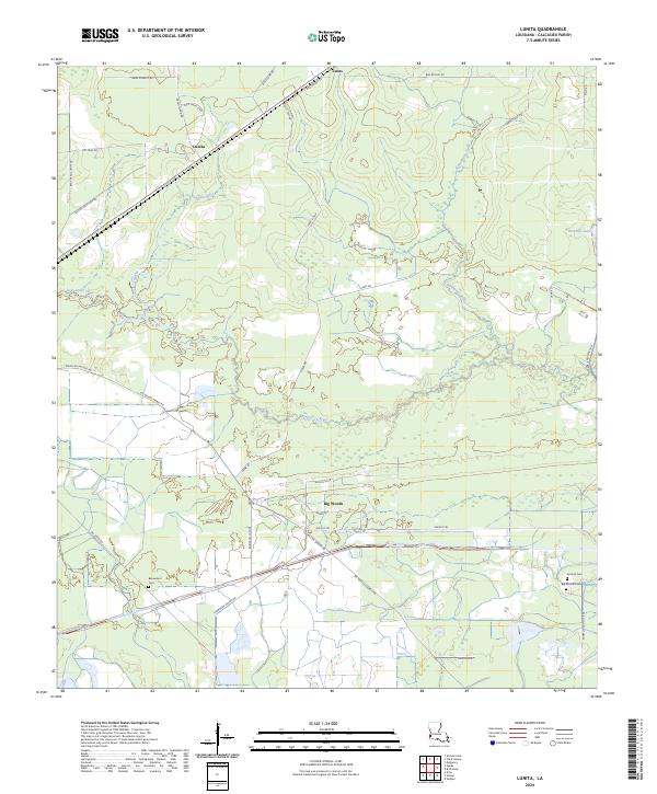
2024 Map of Lunita
USGS Topo · Published 2024About this map
Big Woods and Lunita serve as the primary anchors for this region of Calcasieu Parish, where the low-lying landscape is defined by the winding course of the Houston River. The drainage pattern is complex, with Bear Head Creek and Persimmon Gully cutting through a mix of woodland and marshy terrain, eventually feeding into local water bodies like Richards Lake. The settlement history is deeply rooted in local land use, evidenced by the concentration of cemeteries such as Benevolent Cem, Antioch Cem, and Big Woods Cem, which provide essential points of reference for genealogists and local historians studying early parish families.
Find a feature on this map
42 named features on this map. Tap any name to fly to it.
Don’t see what you’re looking for? This feature index may not catch every label — zoom into the map to look around manually.
Map Details
Editions of this 2024 Lunita Map
This is the sole edition of this map. No revisions or reprints were ever made.
Other maps of this area

1932 · Orange
USGS Topo · 1:62,500

1947 · Sulphur
USGS Topo · 1:31,680

1947 · Starks
USGS Topo · 1:31,680

1947 · Vinton
USGS Topo · 1:31,680

1947 · Toomey
USGS Topo · 1:31,680

1947 · Carter Creek
USGS Topo · 1:31,680

1947 · DeQuincy
USGS Topo · 1:31,680

1947 · Sulphur Mines
USGS Topo · 1:31,680

1947 · Lunita
USGS Topo · 1:31,680

1947 · Long Marsh
USGS Topo · 1:31,680